Next: 2.5 Further reading and Up: 2. Subsurface Stresses and Previous: 2.3 Horizontal stresses Contents
 . Look up for mineral densities in the web in trusted sources. Provide answer in psi/ft, MPa/km, and ppg.
), bulk mass density of rock at the seabed is 1,800 kg/m increasing linearly until a depth of 500 m below sea-floor to 2,350 kg/m and relatively constant below 500 m below seafloor. Why would rock bulk mass density increase with depth?
 v.s. depth (MPa v.s. m and ft v.s psi)
in the rock pore space (MPa v.s. m and ft v.s. psi).
v.s. depth (MPa v.s. m and ft v.s psi)
in the rock pore space (MPa v.s. m and ft v.s. psi).
 and
and
 MPa
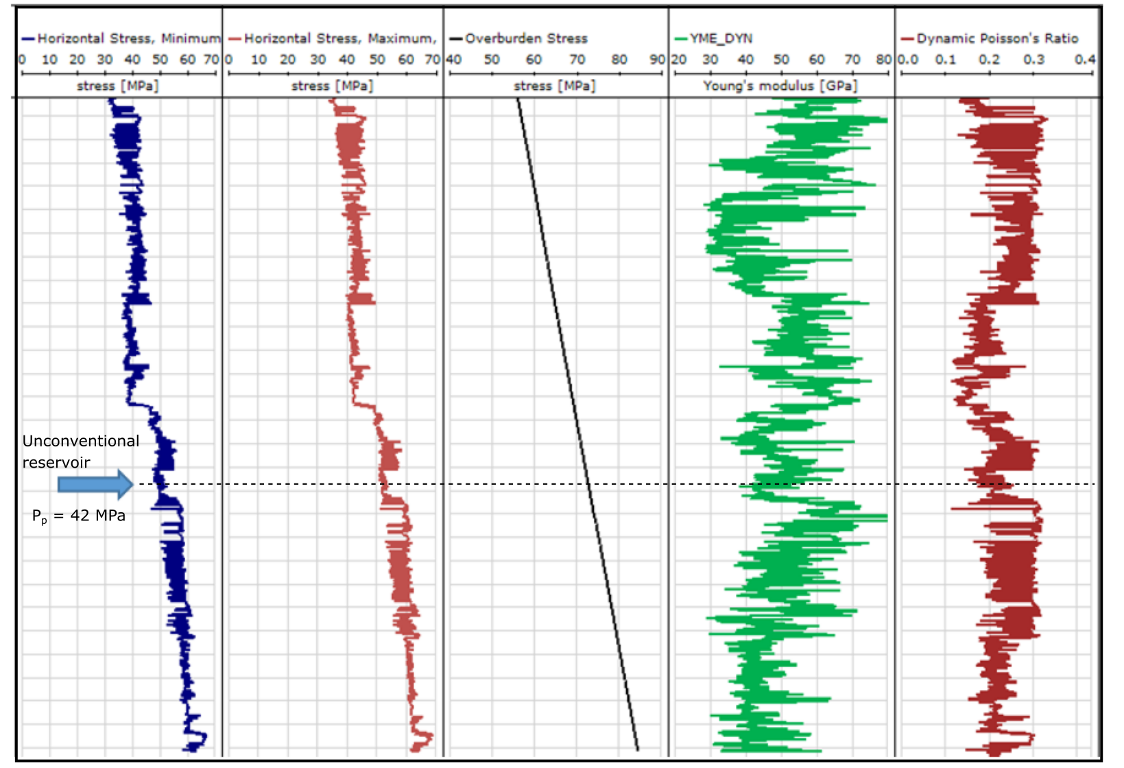
MPa . Estimate the actual pore pressure in the shale. Is there overpressure? At what depth does it start?
Note: You are encouraged to summarize all calculations in a single plot as a function of depth (inverted vertical axis): hypothetical pore pressure, actual pore pressure and total vertical stress.
| Depth | Bulk mass density | Shale porosity | |
 m m![$]$](img274.svg) |
kg/m![$^3]$](img275.svg) |
![$[-]$](img276.svg) |
|
| Water | 0 | 1025 | NA |
| Water | 100 | 1026 | NA |
| Water | 200 | 1026 | NA |
| Water | 300 | 1030 | NA |
| Water | 400 | 1030 | NA |
| Water | 500 | 1031 | NA |
| Sand | 600 | 1900 | NA |
| Sand | 700 | 2190 | NA |
| Sand | 800 | 2200 | NA |
| Sand | 900 | 2230 | NA |
| Sand | 1000 | 2235 | NA |
| Sand | 1100 | 2240 | NA |
| Shale | 1200 | 2275 | 0.305 |
| Shale | 1300 | 2305 | 0.297 |
| Shale | 1400 | 2310 | 0.286 |
| Shale | 1500 | 2308 | 0.281 |
| Shale | 1600 | 2310 | 0.285 |
| Shale | 1700 | 2305 | 0.293 |
| Shale | 1800 | 2310 | 0.307 |
| Shale | 1900 | 2324 | 0.305 |
| Shale | 2000 | 2319 | 0.298 |
 ?.
?.
 |
Note: You may use a plot digitizer (for example, https://apps.automeris.io/wpd/) to obtain numerical data from image files.